Wednesday, December 17, 2014

South Side of Government Square - Then and Now

I came across this photo while researching for a client. I was curious what happened to this block of buildings. These photos come from the Hamilton County Auditor and were found not long ago by their office. They have done an amazing job of digitizing and making them public. Some are even tied to current parcel numbers on the Auditor's website.
South side of Fifth Street between Walnut and Main, circa 1966 - Source
These were such a great collection of classic architectural styles, but I wondered why they were demolished and what took their place. After doing some map hunting, I realized their location, on the south side of Fifth Street, between Walnut and Main. These buildings became a gated park for the Cincinnati Office of the Federal Reserve Bank of Cleveland, which constructed their building at Fourth and Main in 1971.
Cincinnati Office of the Federal Reserve Bank of Cleveland, Hamilton County Audior
But why? The 1960's were a time of urban renewal throughout the country and this also impacted Cincinnati. Buildings like these above were considered outdated and unsuitable to "modern" uses of the Space Age. An article from the Cincinnati Enquirer shows how the city was divided into blocks slated for redevelopment. A 1962 city ordinance allowed for the use of federal urban development dollars to replace "dilapidated business buildings in blighted areas of Cincinnati ...with fine, new, privately-owned buildings, with the help of private industry" Source

While it is hard to determine the exact age of each of these buildings, all but one appear on the 1887 Sanborn Insurance Map. The following maps document the changes in the block for 127 years.

1887 Sanborn Insurance Map - Source
1904-1930 Sanborn Insurance Map - Source
1950 Sanborn Insurance Map - Source
2014 CAGIS Property Maps- Source
A view of this block from the early 1920's
Source
A view looking east on Fifth Street from Fountain Square, showing the change in the block.
Source
And here is the view today, courtesy of Google Street View Maps:


Today, the preservationist realize how the urban development plans of the past allowed for the demolition of much of our city's historic structures. They work to develop a balance of recognizing the city's architectural past and the need for modern facilities. However, it seems a private park on prime central business district real estate was a mistake for the demolition of these structures.

Wednesday, December 10, 2014

The Story of an OTR Tiny Row House

The owner of this home contacted me for the history in preparation of the first Over-the-Rhine Holiday Home Tour. This self-guided holiday home tour is the first annual fundraiser for Future Leaders OTR. So off I went to dig up some big information for this cute, little home.
Photo Source – http://www.mikkischaffner.com/
This tiny row house was built circa 1845 for Joshua Yorke along with the other five houses surrounding it. The original street name was Madison Street, named for the President of the United States. Other streets in the neighborhood were also named for former presidents. The street was renamed Magnolia in 1890, when it was determined there were too many street named Madison within the city, five in total.
Source
These buildings were originally constructed as rental property by comparing the ownership information to the city directories. Mr. Yorke retained ownership until 1864, when he sold the entire strip (except for 217 Magnolia) to George Moessinger. In the same year, Mr. Moessinger sold 219 Magnolia to H. P. Seibel, who had purchased 217 Magnolia in 1858.
1887 Sanborn Insurance Map, property outlined in red - Source
Mr. Siebel was the owner and landlord of the home until 1873, when he sold it to Phillip Kling, who continued as landlord. The Kling family were the owners for 40 years, selling it in 1913 to Emelie Francis, who in turn sold it in 1920 to John Breier.
1887 Sanborn Insurance Map, property outlined in red - Source
In 1924, Mr. Breier sold the building to Arthur and Henrietta Kerber, who were the first owners to also make the house their permanent residence. They owned the home until 1951, when it was transferred to Henrietta’s son, Myron Carstens, and then back to Henrietta in 1954. Mt. Healthy Savings & Loan took ownership in 1965 and sold it the same year to George Gamzu and Max Szyka. In 1979, Upgrade Construction Company purchased the home and remained owners until 1994. Gladys O Neal took ownership in 1994 and sold it in 2005 to Paul Graves, who sold it to the present owner in 2013.

The tenants of the home for approximately 79 years had a wide variety of occupations. Starting with the 1849-50 city directory, the south side of the street had at least 11 families listed. It is impossible to determine which one lived in this home, but you can tell that it was a popular location to live. Definite residents start in 1853, with the previous address of 21 Madison appearing in the directory for the first time. Some of the occupations listed are piano manufacturer, editor of a German newspaper - The Cincinnati Freie Presse, teacher, tailor, foreman, blacksmith, engraver, printer, cutter, fireman, machinist and salesman.
Cincinnati Enquirer (1872-1922); Jan 18, 1920; pg. 33
ProQuest Historical Newspapers: The Cincinnati Enquirer (1841 - 1922)
One newspaper article mentions the 1919 arrest of Bettie Reeves, a garment worker who was striking in the 1920 Garment Workers’ Strike in Cincinnati. While picketing with others, she tried to convince a  nonunion garment worker not to deliver coats made by nonunion workers.  Bettie Reeves was charged and convicted with accessory to robbery after one of her fellow picketers stole the coats from the nonunion worker. Clarence Darrow (the famous attorney from Chicago) represented Bettie in an appeal for a new trial in 1920, arguing her only intent was to prevent work being done by a nonunion worker and “robbery must include intent to take something of value.” Ohio Governor James M. Cox pardoned her on his last day in office in 1921. One wonders whether he’d have done so if he’d won the Presidential election months earlier. Cox lost the race to another Ohioan, Warren G. Harding, despite having future President Franklin Delano Roosevelt as his running mate.
Source
Source
Source
As can be expected in Over-the-Rhine, the first residents came from primarily Germany, according to the census records for 1850. In 1860, the tenant and his wife were born in Virginia. Owner H. P. Seibel, born in Bavaria, did live for a short time at this house, but primarily lived next door at 217 Magnolia. By 1920, the demographics of Over-the-Rhine were changing to new immigrants from the southern states. In the census for this year, the residents were born in Kentucky.  This remained the same for the 1930 and 1940 censuses as well.

This tiny row house has been lovingly updated by the present owner, who added her own touches to this little house with lots of history.

1999-2003

2005


The following photos were taken by Mikki Schaffner after renovations were completed this year.


Friday, November 21, 2014

Origins of UC - Cincinnati College

I came across this picture today which led me to wonder just where this building once stood.
Cincinnati College Edifice.
Doolittle & Munson. Woodcut. 3&13/16 x 5 in (9.68 x 12.70 cm). Youth's Magazine 2, no. 23 (September 2, 1836), p. [353]. Cincinnati Historical Society Library. http://bit.ly/1F9Ve4B
This building was located on the east side of Walnut Street, just north of Fourth Street, according to this map from 1838, by Joseph Gest and William Haviland.


Here are pages from the Cincinnati Directory Advertiser from 1836-37 describing the college:


In 1918, Cincinnati College merged with the University of Cincinnati, which was chartered by the Ohio legislature in 1870. In 1893, the university moved to its present location, which was originally part of Burnet Woods.

Wednesday, October 8, 2014

Where Did They Go? - A Cemetery Mystery

A follower asked about the former cemetery between Dayton and York Streets, near Central Avenue that could be seen in my previous blog post.

1869 Titus Map - Source
I did some digging and it was originally listed as the United Protestant Evangelical German St. Peter's Church Cemetery. It is mentioned in newspaper articles in 1849-1850. during the cholera epidemic. On the list below, it is marked as German Protestant (St. Peter's) Western Row. Central Avenue was originally called Western Row, since it was the western edge of town.
The Cincinnati Enquirer (1849-1852); Jul 19, 1850; pg. 2
ProQuest Historical Newspapers: The Cincinnati Enquirer (1841 - 1922)

Cincinnati, R.C. Phillips C. E., 1869 - Source
Around the same time as the epidemic, because so many of the cemeteries were getting full, the Vine Street Hill Cemetery opened. It was originally called the German Evangelical Protestant Cemetery and then the Carthage Road Cemetery. Carthage Road was the name of this portion of present-day Vine Street, before its annexation to Cincinnati. The cemetery gained its current name around 1920.

The Cincinnati Enquirer (1849-1852); Oct. 12, 1871; pg. 5
ProQuest Historical Newspapers: The Cincinnati Enquirer (1841 - 1922)
In 1871, the remains buried in the West End cemetery were removed and reinterred at the Vine Street Hill Cemetery. This land was then sold John Windisch and John Hauck, of the Hauck and Windisch Brewery (also known as the Dayton Street Brewery) for expansion of their operations.
The Cincinnati Enquirer (1849-1852); Feb. 27, 1873; pg. 7
ProQuest Historical Newspapers: The Cincinnati Enquirer (1841 - 1922)
In 1879, John Hauck bought out John Windisch, and in 1881 the brewery became the John Hauck Brewing Company.
1891 Sanborn Insurance Map - Source
Click to Enlarge
1904 Sanborn Insurance Map - Source
Click to Enlarge
When prohibition came in 1919, the brewery stayed open by producing near beer, soda and ice. It also began renting space to the Red Top Brewing Company.
1904-1930 Sanborn Insurance Map - Source
Click to Enlarge
In 1933, with the repeal of prohibition, Red Top Brewery continues its lease at the plant. By 1945, Red Top Brewing Company expands to a second plant and becomes one of the largest in Ohio.
Source

1950 Sanborn Insurance Map - Source
Click to Enlarge
With increasing demand for national brands, Red Top Brewery closed in the late 1950's. While many of the brewery buildings have been demolished, the original two story barn and wagon shed, built on the cemetery grounds, still stands today. Another brewery building fronting Central Avenue also remains.
2014 CAGIS Map
2014 Google Earth
Google Streetview, July 2014
The former brewing property is presently owned by The Kaiser Pickle Company, in business since 1920. The German history comes full circle. At least pickles go with beer, right?

Brewery history gathered from Cincinnati Brewing History.

Sunday, October 5, 2014

Soap and Hospital Surprise

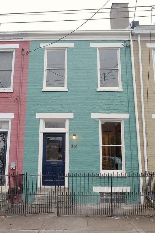
I researched the subject for this post over a year ago, but I thought the story was interesting to share with all of you. A follower contacted me for information on the house when he purchased it in 2012, so I did some digging and came up with a couple of surprises.
526 York Street, on the right - Source: Google Streetview, July, 2014
Using 1869 Titus Map and the legal property description, I came upon my first surprise. The lot where this home was constructed was originally owned by one of the founders of Procter & Gamble, James Gamble.
1869 Titus Map - Source
James Gamble's own home was on Clark Street, south of this location, so it appears this land was purchased as an investment. The Hamilton County Auditor dates the construction of this home as 1865, which seems to be a pretty accurate date based on the city directory information and the architectural style.

Using the 1891 Sanborn Insurance Map, I discovered the address for this house was 50 York Street before the 1895-1896 street renumbering project. This allowed me to research the city directories to discover the residents of the home. In 1865, three names were listed: Anton Buerckle, a finisher, Jacob Kern, a laborer, and Charles Reitzel, also a finisher. However, in 1870, only one name is listed: Harrison Dexter, a lumber dealer whose business was located just down the street at the corner of York and Freeman. However, the 1870 Census doesn't list him as the owner of the property, so he was renting this from another person.
1870 United States Census - Ancestry.com
1880 United States Census - Ancestry.com
Look far to the left to see the address of "50", confirming these are the residents of 50 York Street at the time of the census.
The Dexter family moved closer to their business in 1886 and in 1888, my next surprise was revealed. When I looked at the 1891 map, something caught my eye...
1891 Sanborn Insurance Map - Source
 Right over the top of 46, 48 and 50 York Street is labeled "Christ's Hospital". I knew Christ Hospital is now in Mt. Auburn and also knew of the support the Gamble family had given it over many years, so this got me curious. I started digging in the Cincinnati Enquirer archives and found this:
Cincinnati Enquirer (1872-1922); Nov 29, 1889; pg. 8; ProQuest Historical Newspapers
So it appears James Gamble owned the home and had given use of it to the founders of Christ Hospital as a place to begin their work. In 1890, the following people were listed as living at 50 York Street:
Deaconess Home, 50 York
ELIZABETH GAMBLE DEACONESS HOME, 50 York
Davis, Mrs. M. deaconess, 50 York
Deakin Rena, deaconess, 50 York
House, Lucilia, deaconess, 50 York
Keeler, Evelyn, lunch room, 76 Freeman Av .h. 50 York
Seal, Martha, deaconess, 50 York
Thoburn, Isabella, supt. The Elizabeth Gamble Deaconess House, 50 York

In 1893, the hospital and deaconess home moved to Mount Auburn and the houses on York Street once again became rental properties. Between 1903 and 1918, the Gamble estate sold the property to Charles Richt, and he sold it to Bertha Schaub, who is living at the home in 1920 with her adult children and another family.
1920 United States Census - Ancestry.com
Cropped to names
After a series of sales between 1925 and 1929, Ida Laugel owned the home until 1946, renting it out to various families over the years. The ownership card below shows the owners until 1990.
Hamilton County Auditor Ownership Card
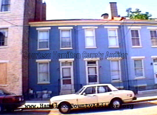
1999-2003

2005


Of the three original Christ's Hospital buildings, only this one remains standing. In 2012 and in 2013, the home was sold again but from the photo at the top of this post, it appears to be vacant, awaiting the current owners to breathe new life into this house of surprises.